Land for Sale Urlabari-7 | 500m from Mahendra Highway
Description
उर्लाबारी-७, मोरङमा पश्चिम मुख रएको आवासीय जग्गा बिक्रीमा — महेन्द्र राजमार्गबाट ६०० मिटरभन्दा कम दूरीमा, सम्पूर्ण सुविधासहित
INTRODUCTION
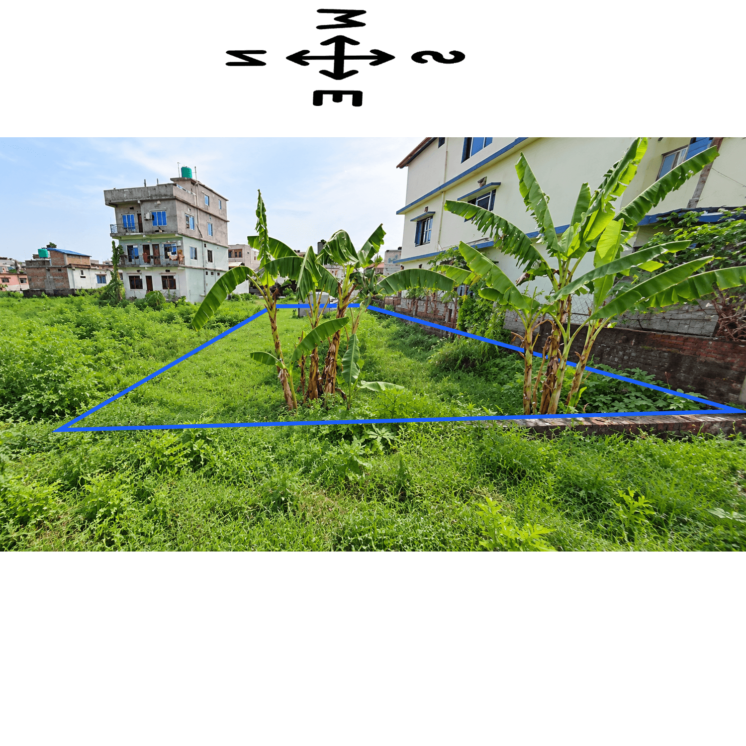
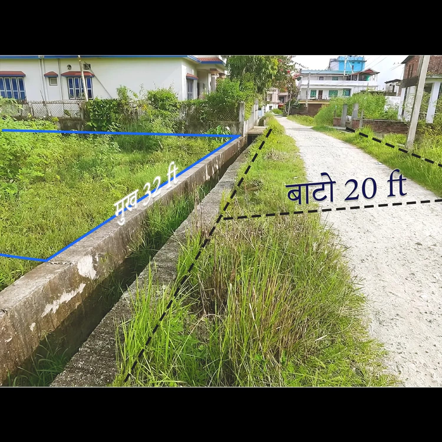
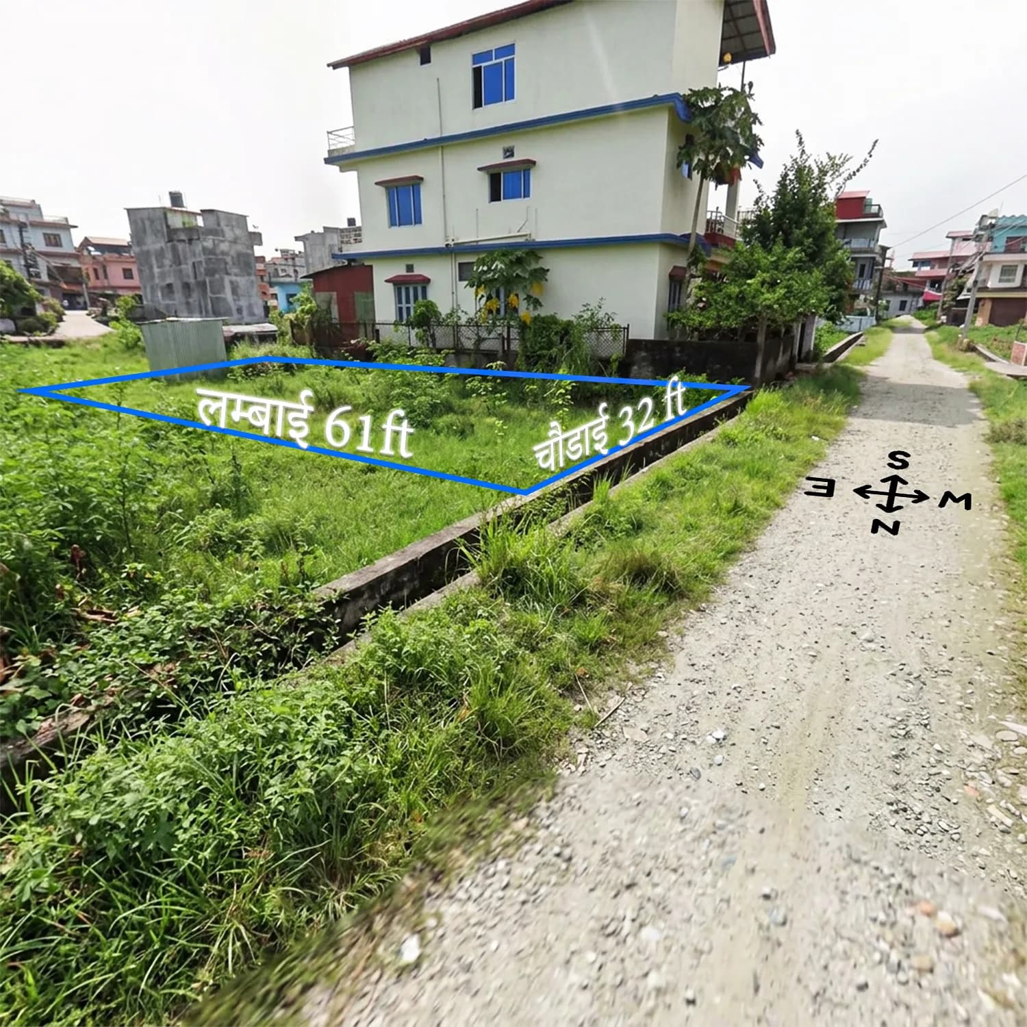
Kitta 2720 at Himalchok, Urlabari-7, Morang is a ~10.75 Dhur (1,952 sq ft) rectangular residential plot (32 ft × 61 ft). It sits less than 500 m from the East-West Mahendra Highway yet on a quiet 20 ft gravel residential lane—highway access without highway exposure. Two schools are 200 m away, Godawari Hospital 500 m, four major banks 500–600 m, and the public bus stop 500 m (all within a 5-minute walk). All six utilities are available; the plot faces west; installment payment is accepted. Land status is subject to owner verification prior to registration.
LOCATION & CONNECTIVITY
Urlabari Municipality lies on the Mahendra Highway, Nepal’s main east-west arterial linking Kakarbhitta to Mahendranagar, with direct access to Biratnagar and the Itahari-Dharan corridor. This plot is under 500 m from the highway junction, offering fast inter-city connectivity while remaining shielded from highway noise in a developing residential neighborhood.
Walkable amenities include Nepal Darshan Higher Secondary School (200 m), Godawari Hospital (500 m), Urlabari Bus Stop (500 m), four major banks (within 600 m), and Urlabari Multiple Campus (1 km)—an exceptionally complete ecosystem for eastern Nepal. Betana Wetland (Ramsar-listed) is 15 km away. Morang’s 1,147,187 residents (2021 Census) support sustained demand.
INVESTMENT OPPORTUNITY
Urlabari land has appreciated 10%–20% annually, driven by its position on the Biratnagar-Itahari corridor and ongoing highway-belt infrastructure growth. Government minimum valuation is NPR 2,50,000 per dhur; current market range is NPR 4,00,000–5,00,000 per dhur. The premium reflects sub-500 m highway proximity, full utilities, and 5-minute access to schools, hospital, and banks.
West-facing orientation holds Vastu significance for Nepal’s Hindu majority, supporting buyer preference and resale demand. Installment options reduce upfront capital for families and NRN investors.
“WHY THIS PLOT?"
| Feature / Criteria | This Property (Kitta 2720, Urlabari-7) | Typical Urlabari / Morang Market Average |
| Price per Dhur (Range) | NPR 4,00,000–5,00,000 | NPR 2,50,000–4,50,000 (varies by road/highway distance) |
| Mahendra Highway Distance | Less than 500m (walking distance) | 1–5 km average for residential plots |
| Nearest School Distance | 200m (2 schools at same distance) | 1–3 km average in residential zones |
| Nearest Hospital Distance | 500m (Godawari Hospital) | 2–6 km average for periurban plots |
| Nearest Bank Distance | 500m (4 banks within 600m) | 1–3 km average; rarely 4 banks within 600m |
| Road Width | 20 ft gravel road | 10–16 ft earthen in most residential lanes |
| Utility Completeness | 6 of 6 — all confirmed available | Typically 3–4; irrigation/sewer often absent |
| Land Facing | West (Vastu-auspicious) | Mixed — west-facing plots rare and sought-after |
| Flood / Landslide Risk | None (flat terrain, verified) | Moderate flood risk in lower-elevation Morang zones |
| Annual Appreciation Rate | 10%–20% documented | 5%–12% average in non-highway residential areas |
| Walkability (Daily Needs within 1 km) | ✅ Exceptional — school, hospital, 4 banks, bus stop, college all within 200m–1km | ❌ Typically requires vehicle for most daily services |
| Payment Flexibility | ✅ Installment available | Lump sum typically required by most private sellers |
What this means for your decision: No comparable plot in the Urlabari market currently combines highway proximity under 500m, a complete 5-minute walk radius for daily essentials, and six confirmed utilities on a west-facing, flat, road-level plot. The price premium over government valuation is directly supported by each of these measurable advantages — not by speculative future development alone.
FAQ SECTION
Q1: Current land price per dhur in Urlabari, Morang (2025)?
Residential land trades at NPR 4,00,000–5,00,000 per dhur for highway-proximate, fully serviced plots. Government minimum valuation is NPR 2,50,000 per dhur. Premium reflects infrastructure, walkability, and Mahendra Highway proximity, driving 10%–20% annual appreciation.
Q2: Distance from Mahendra Highway?
Kitta 2720 at Himalchok, Urlabari-7 is less than 500 m from the East-West Mahendra Highway (under 7-minute walk). It sits on a 20 ft gravel residential lane—accessible yet free of direct highway traffic. Urlabari Chowk is 700 m away; Bargachhi Chowk is 600 m.
Q3: Is Urlabari good for a family home?
Urlabari is one of Morang’s most service-complete municipalities on the Mahendra Highway between Biratnagar and Itahari. Ward 7 offers walkable schools (200 m), hospital (500 m), banks (500–600 m), and public transport (500 m). Morang’s 2021 population of 1,147,187 confirms strong urban demand.
Q4: Schools and hospitals nearby?
Yes. Nepal Darshan Higher Secondary School and Pashupati Awasiya Ma. Vi. are both 200 m away (3-minute walk). Godawari Hospital is 500 m; Urlabari Multiple Campus is 1 km; Madan Bhandari Hospital and Trauma Center is within 3.5 km. This walking-distance concentration is uncommon in eastern Nepal.
Q5: Flood and landslide risk?
Zero flood and landslide risk. The plot has plain/flat topography at road-level elevation, is rectangular and level, and free of drainage issues common in low-lying Terai zones. (Owner disclosure; independent verification recommended.)
Q6: Installment payments possible?
Yes. Installment plans are available, reducing upfront capital for family buyers and NRNs. Registration fees follow Government of Nepal rates. Terms (schedule, down payment, duration) are negotiable and must be documented before registration.
Plots within 500 m of the Mahendra Highway at this price are limited in Urlabari.
Visit Kitta 2720, Himalchok, Urlabari-7, Morang Schools, hospital, and banks are within walking distance. Installment plans available. Contact the listing agent to schedule a site visit.
Location
Specifications
🏡 Plot Details & Boundaries
🛣️ Road & Accessibility
💡 Utilities & Infrastructure
📊 Investment & Neighborhood Insights
Free tool
Land unit converter
This listing's area is loaded below — convert the plot into Ropani, Aana, Paisa, Daam, Bigha, Katha, Dhur, sq. ft and more.
Quick reference
Your area in every unit
The total above, expressed in every supported unit — including the exact Ropani / Aana / Paisa / Daam (or Bigha / Katha / Dhur) breakdown.
- Ropani0.0357926886
- Aana0.5726830168
- Paisa2.290732067
- Daam9.162928269
- Bigha0.02688625
- Katha0.537725
- Dhur10.7545
- Sq. ft196.0007625
- Sq. m18.20905884
- Sq. yd21.7778625
- Acre0.0044995584
- Hectare0.0018209059
- Km²0.0000182091
One-tap conversions
Common conversions
Tap any card to load that conversion instantly.