land for sale in Kanepokhari-7 | NPR 1 L/Dhur - Near Mahendra Hwy
Description
कानेपोखरी-७, मोरङमा आवासीय जग्गा बिक्रीमा — महेन्द्र राजमार्गबाट मात्र २.५ किमि, सम्पूर्ण सुविधासहित
INTRODUCTION
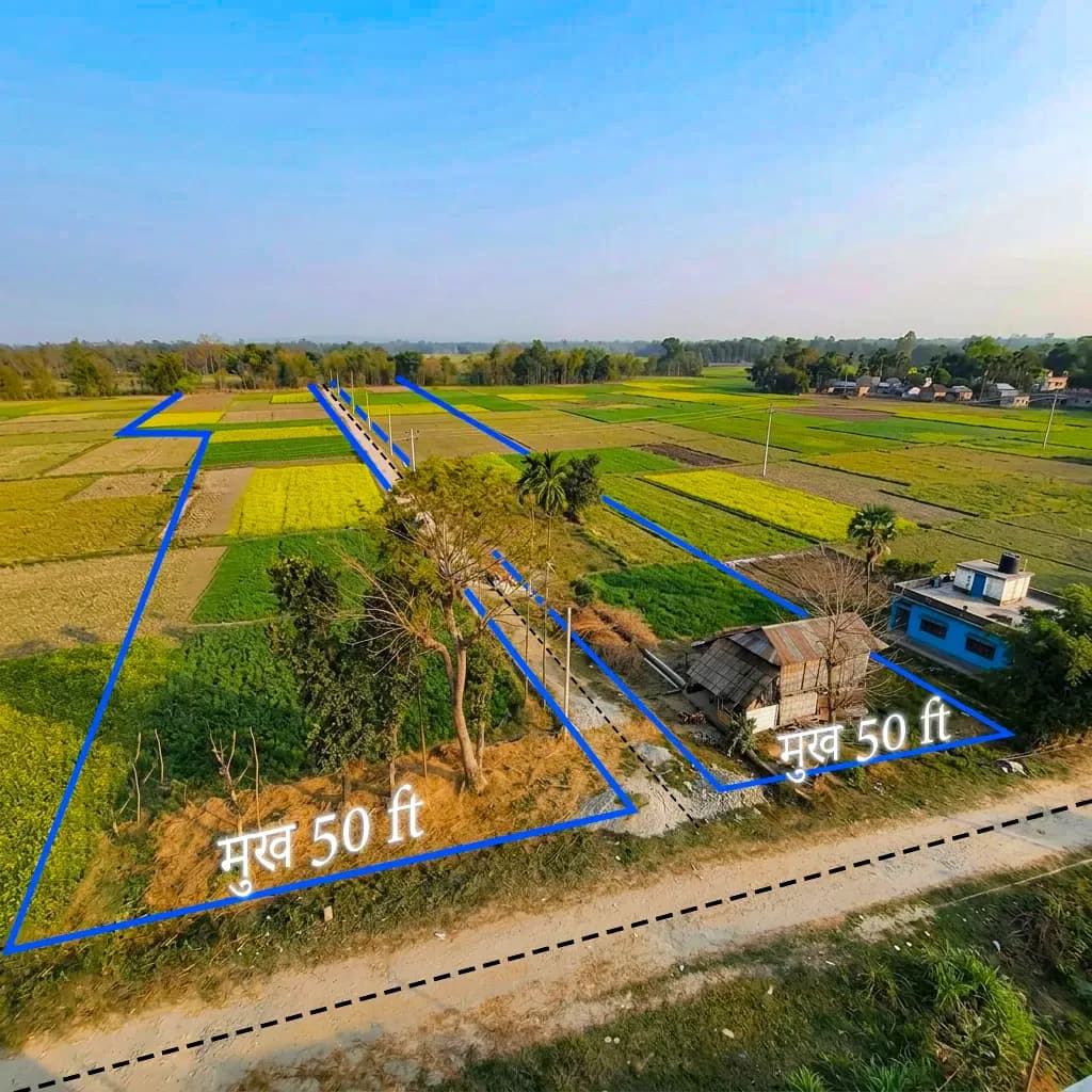
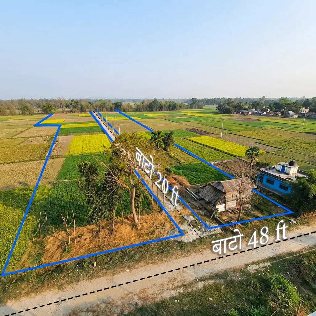
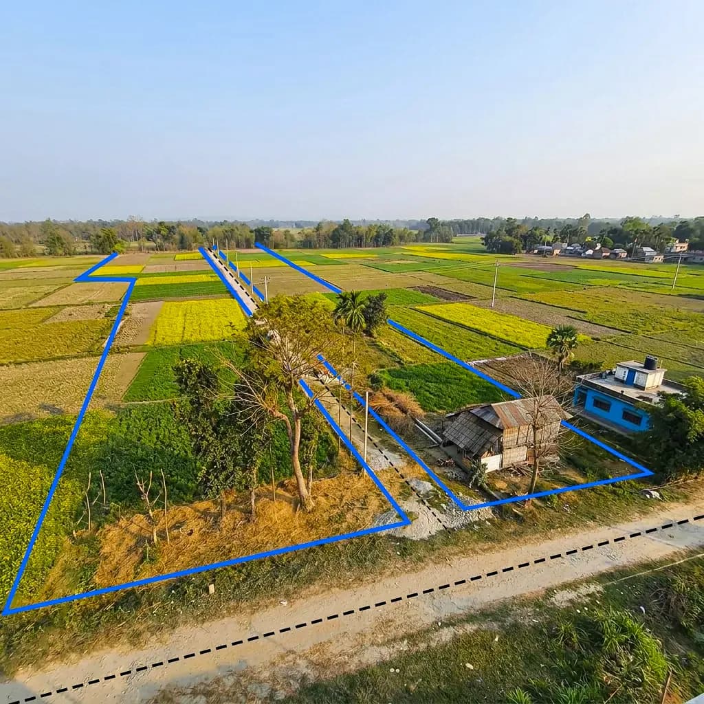
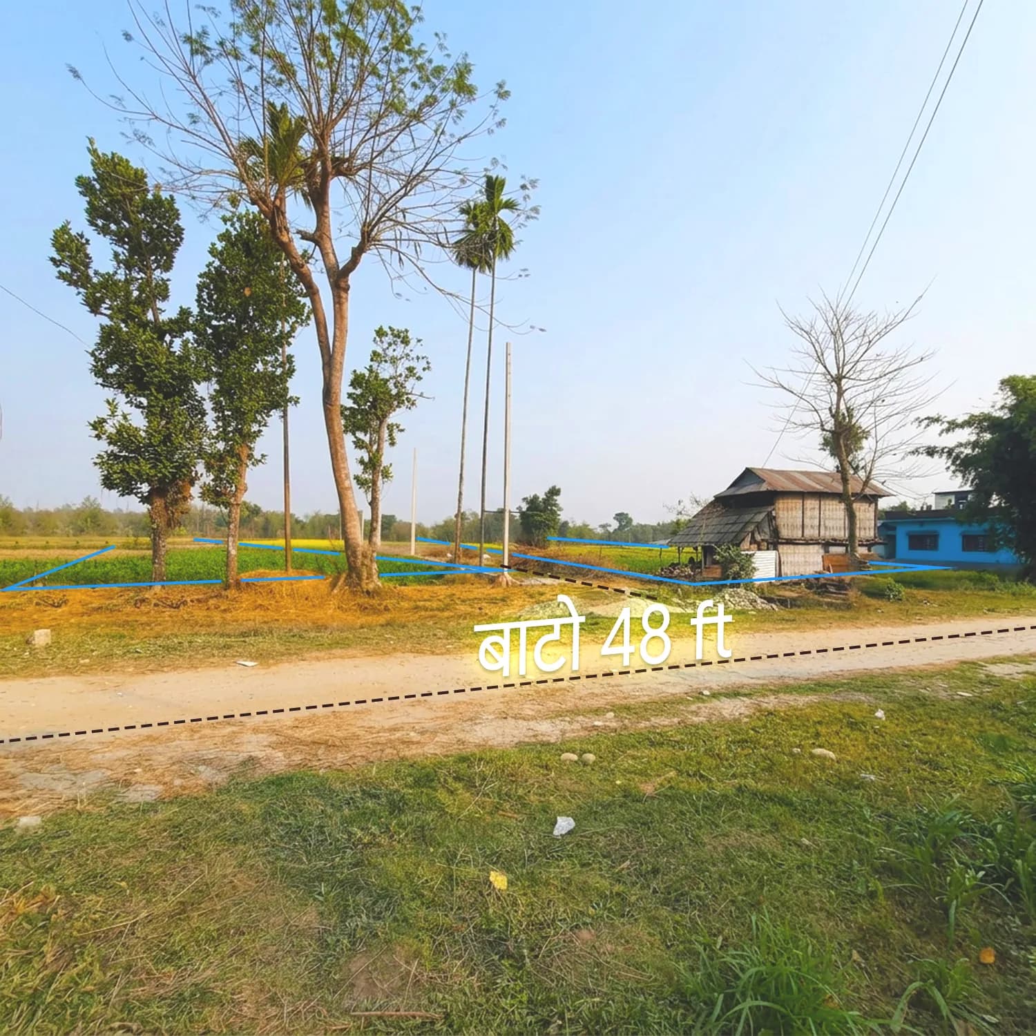
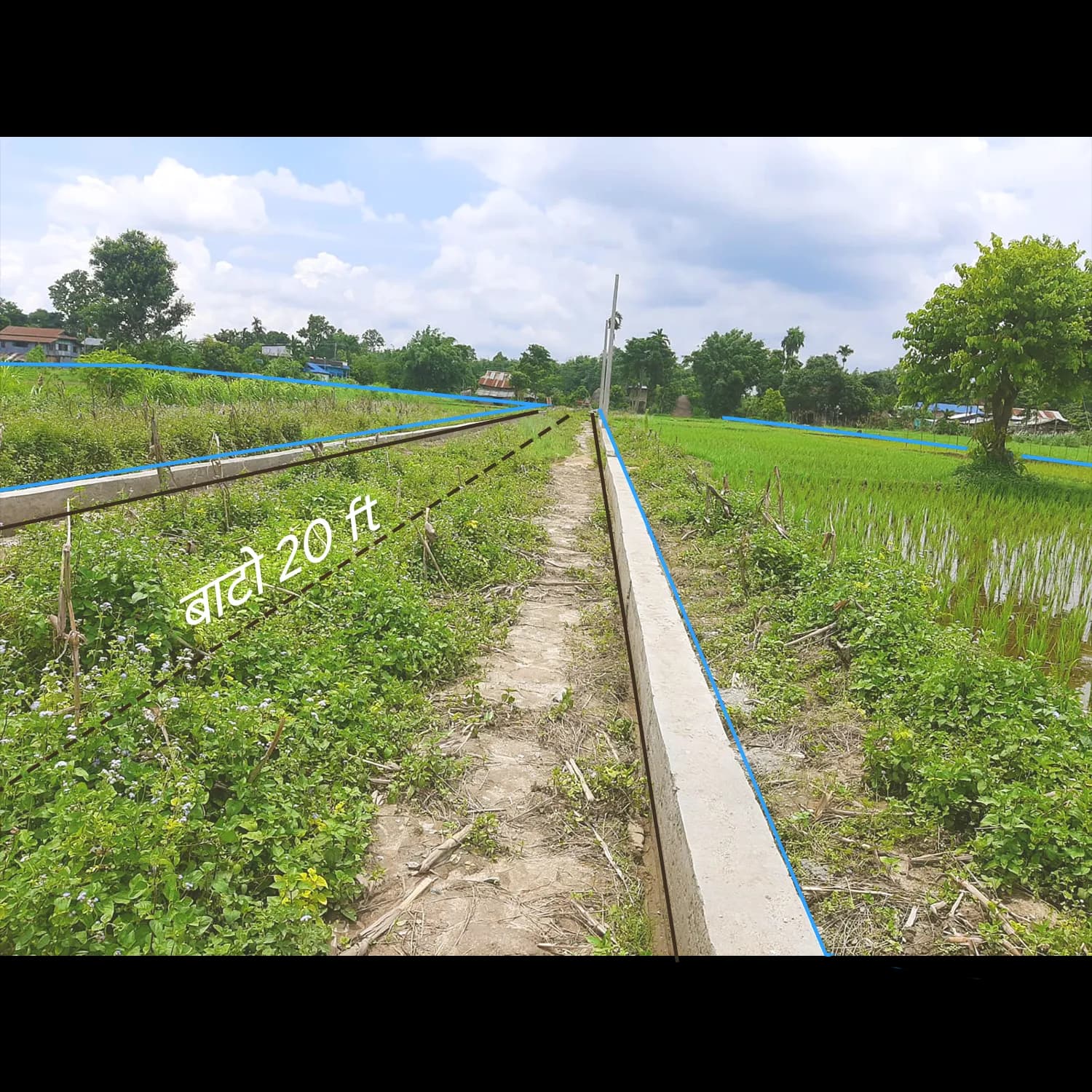
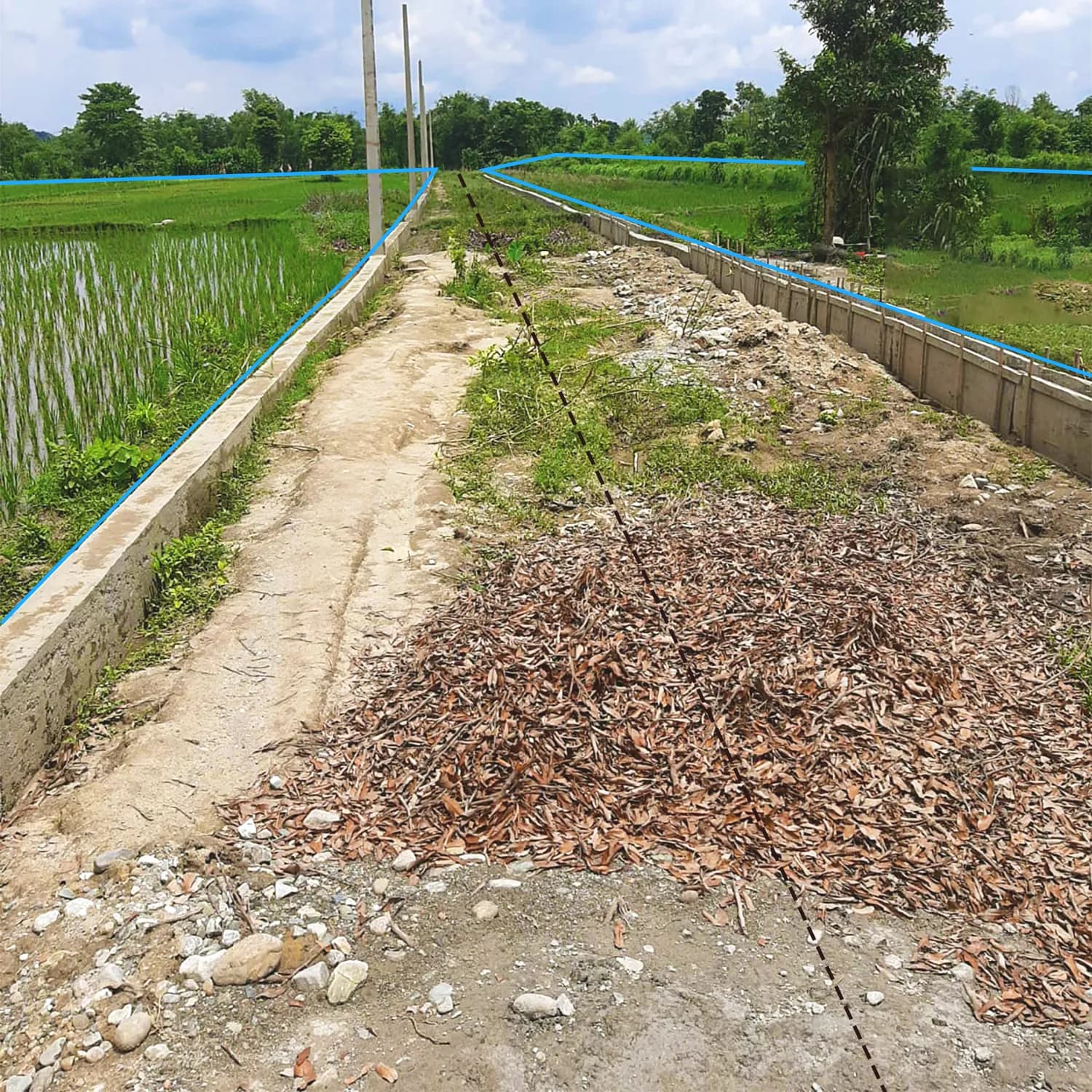
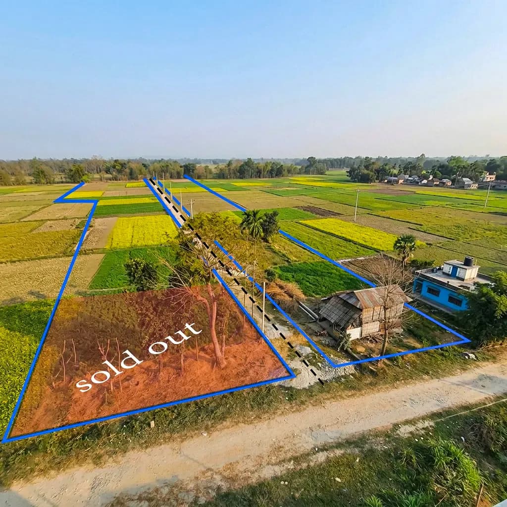
At Aitabary, Kanepokhari-7, Morang, Koshi Province (GPS: 26.6367°N, 87.5068°E), this 320 Dhur rectangular land parcel is one of the largest contiguous residential and agricultural blocks currently available in Morang's developing rural corridor. Spanning 12 adjacent kittas (966–980) on flat, road-level terrain, the property sits 1 km from the Kanepokhari–Rangeli Feeder Road and 2.5 km from the East-West Mahendra Highway — giving both residential families and agricultural investors direct access to eastern Nepal's primary road network. All utilities — including irrigation — are confirmed available as per owner disclosure. The property is currently held as bank collateral; loan clearance and clean title transfer will be facilitated as part of the standard transaction process. Installment payment is accepted. Kitta 967 carries dual road frontage — 48 ft main road (west-facing) and south-facing internal access — making it the parcel's strategically premium kitta.
LOCATION & CONNECTIVITY
Kanepokhari Rural Municipality sits in a growth corridor in southern Morang. It connects northward to the East-West Mahendra Highway at Kanepokhari Chowk (2.5 km) — Nepal’s main east-west artery from Kakarbhitta to Mahendranagar — and southward to Rangeli via the Kanepokhari–Rangeli Feeder Road (1 km from the site). This dual access gives residents and agricultural operators direct logistics links to Biratnagar (east) and the Itahari-Dharan corridor (west) without highway-frontage costs.
Ramailo Bazar (3 km south) provides the nearest commercial hub with NIC Asia and Rastriya Banijya Bank, Ramailo Multiple Campus, Janasewa Higher Secondary School, a police post, and the local bus stop. Kanepokhari pond (2.0–2.5 km north), the municipality’s namesake natural and cultural landmark, supports long-term livability on this flat, irrigated land. Morang’s 1,147,187 residents (2021 Census) underpin demand, while Kanepokhari Gaupalika’s 43,193 population confirms its early-stage character and early-mover advantage.
INVESTMENT & DEVELOPMENT
At NPR 3,00,000–4,00,000 per dhur, the full 320 dhur parcel totals approximately NPR 9.6–12.8 Crore — development-grade scale at rural-municipality pricing, well below equivalent blocks in Itahari or Biratnagar. Annual appreciation of 12%–20% ranks among the highest in eastern Nepal, driven by improving feeder-road connectivity and rising residential demand along the Mahendra Highway belt.
Government minimum valuation is NPR 2,00,000 per dhur; the current range reflects a 50–100% market premium justified by irrigation, feeder-road access, and full utilities. The 12-kitta layout allows flexible entry: families can buy 1–2 kittas for a private compound, while developers can acquire the full block for a 20–40 plot housing colony. Installment options lower the capital threshold. Irrigation and the Terai climate (16°C–45°C) also support year-round agriculture — paddy, wheat, vegetables, and sugarcane are all commercially grown here.
COMPARISON SECTION — "WHY THIS PARCEL?"
| Feature / Criteria | This Property (Kitta 966–980, Kanepokhari-7) | Typical Morang / Kanepokhari Market Average |
| Total Land Area (Dhur) | 320 Dhur — contiguous residential/agri block | 10–50 Dhur typical; 320-Dhur residential blocks are rare |
| Price per Dhur (Range) | NPR 3,00,000–4,00,000 | NPR 2,50,000–5,00,000 (varies widely by road/highway access) |
| Mahendra Highway Distance | 2.5 km north (Kanepokhari Chowk) | 3–10 km average for comparable rural Morang plots |
| Feeder Road Access | 1 km to Kanepokhari–Rangeli Feeder Road | Direct feeder road access uncommon for large rural parcels |
| Nearest Commercial Hub | 3 km south (Ramailo Bazar — full banking, education, transport) | 4–8 km average in comparable Kanepokhari gaupalika areas |
| Nearest School / Campus | 2 km (Ramailo Baljagat; Mount Hermon; Pinnacle) | 3–6 km average in rural Morang residential zones |
| Nearest Hospital | 2 km north (Bayarban Hospital Kanepokhari) | 5–15 km in most rural Morang locations |
| Nearest Bank | 3 km south (NIC Asia, RBB, Miteri) | 4–8 km average; rarely 3 banks at same distance |
| Utility Completeness | 5/6 confirmed (electricity, water, sewerage*, internet, irrigation) | Typically 2–3; irrigation + internet rarely co-present |
| Irrigation Availability | ✅ Yes — year-round Terai cultivation supported | Absent in majority of rural Morang residential listings |
| Flood / Landslide Risk | None (flat terrain, confirmed) | Moderate flood risk in lower-elevation Morang zones |
| Annual Appreciation Rate | 12%–20% documented corridor growth | 5%–10% average for non-highway rural Morang land |
| Land Configuration | 12 contiguous kittas — full block or individual kitta purchase | Single kitta or fragmented multi-owner blocks typical |
| Payment Flexibility | ✅ Installment + phased kitta purchase available | Lump sum typically required for large parcels |
What this means for your residential or investment plan: A contiguous 320-Dhur block with irrigation, feeder road connectivity, confirmed utilities, and installment flexibility — at rural-municipality pricing — is a configuration that does not currently exist elsewhere in the Kanepokhari market. Whether the buyer is a residential family acquiring 1–2 kittas for a private homestead or a developer planning a 20–40 plot colony, this parcel accommodates both at a price point that Itahari and Biratnagar comparables cannot match.
FAQ SECTION
Q1: What is the current land price per dhur in Kanepokhari, Morang in 2025?
Residential and agricultural land trades at NPR 3,00,000–4,00,000 per dhur for road-accessible, serviced plots. Government minimum valuation is NPR 2,00,000 per dhur. The 50–100% premium reflects feeder-road access, irrigation, and Mahendra Highway proximity (2.5 km).
Q2: Is Kanepokhari a good location for a housing project or residential development?
Yes. Kanepokhari offers an early-mover entry for individual buyers and colony developers. This Aitabary, Ward 7 parcel provides 320 contiguous dhur of flat, irrigated land, 2.5 km from the Mahendra Highway, with 12%–20% annual appreciation — significantly more affordable than equivalent blocks in Itahari or Biratnagar.
Q3: How far is this land from the Mahendra Highway and Biratnagar?
The property at Aitabary, Kanepokhari-7 (GPS: 26.6367°N, 87.5068°E) is 2.5 km south of the Mahendra Highway at Kanepokhari Chowk via the Kanepokhari–Rangeli Feeder Road (1 km from site). Biratnagar is approximately 20–25 km east via the highway.
Q4: Can I buy a portion of this 320-dhur land, or must I purchase all 12 kittas?
The 12-kitta block (Kitta 966–980) allows partial purchase. Families can buy 1–2 kittas for a private residence and farm; developers can acquire the full 320 dhur. Minimum area and pricing are negotiable. Installment payment is available.
Q5: Is agricultural land in Kanepokhari irrigated and suitable for year-round farming?
Yes. Irrigation is available (owner disclosure). Flat Terai terrain and 16°C–45°C climate support year-round cultivation of paddy, wheat, vegetables, and sugarcane. Suitable for both family-scale farming with a residence and full commercial agricultural use.
Q6: What is the annual land price appreciation rate in Kanepokhari Rural Municipality?
12%–20% — among the highest in eastern Nepal’s rural municipalities. Growth is driven by improving feeder-road connectivity, rising residential demand, and spillover from the Biratnagar-Itahari corridor. At current prices the market remains in an early-appreciation phase.
This 320-Dhur contiguous parcel — with residential, agricultural, and development potential — has no direct comparable in the current Kanepokhari market.
Inspect the site at 26.6367°N, 87.5068°E, Aitabary, Kanepokhari-7, Morang — 2.5 km from Mahendra Highway, 1 km from the feeder road. Individual kitta purchase and installment payment available. Contact the listing agent to schedule a site visit today.
Location
Specifications
🏡 Plot Details & Boundaries
🛣️ Road & Accessibility
💡 Utilities & Infrastructure
📊 Investment & Neighborhood Insights
Free tool
Land unit converter
This listing's area is loaded below — convert the plot into Ropani, Aana, Paisa, Daam, Bigha, Katha, Dhur, sq. ft and more.
Quick reference
Your area in every unit
The total above, expressed in every supported unit — including the exact Ropani / Aana / Paisa / Daam (or Bigha / Katha / Dhur) breakdown.
- Ropani1.065010957
- Aana17.04017531
- Paisa68.16070124
- Daam272.642805
- Bigha0.8
- Katha16
- Dhur320
- Sq. ft5,832
- Sq. m541.810296
- Sq. yd648
- Acre0.1338842975
- Hectare0.0541810296
- Km²0.0005418103
One-tap conversions
Common conversions
Tap any card to load that conversion instantly.